Aerial Survey
- Photogrammetry, LiDAR, hyperspectral
- Fixed-wing and helicopters
- Design approval EASA.21J.849
- Part-145 at Kunovice
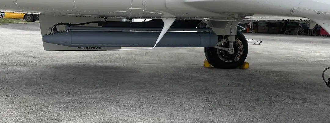
Turn the aircraft you already fly into a survey platform that delivers clean, geo-referenced data. AIR TEAM Intel integrates mapping cameras, laser scanners and hyperspectral sensors with mount, power, operator station and navigation, and certifies the installation.
Mission profiles
Topographic mapping
Orthophoto and 3D models over large areas from fixed-wing aircraft, for mapping, infrastructure and urban planning.
Terrain and flood models
LiDAR elevation models (DEM/DSM) for watershed analysis, flood modelling and mining volumes.
Coastal and bathymetric survey
Green-laser bathymetric scanners map coastlines and shallow water in the same flight.
Corridor and powerline survey
Low, high-resolution helicopter scans of roads, railways, pipelines and powerlines.
Environment and resources
Hyperspectral imaging for mineral exploration, vegetation health and environmental monitoring.
Change detection
LiDAR combined with EO/IR or multispectral data to see what has changed between surveys.
Sensors and systems
We fit the sensor your survey needs. The OEM names are examples of the classes we integrate.
Mapping cameras
High-resolution photogrammetry cameras for 2D orthophoto and 3D models.
Laser scanners
RIEGL VQ-1560 II-S and Leica TerrainMapper-2 class for wide-area and corridor work; RIEGL miniVUX-3UAV for small platforms.
Bathymetric LiDAR
RIEGL VQ-840-G or Teledyne Optech CZMIL SuperNova class for coastal and shallow-water mapping.
Hyperspectral imaging
Imaging spectrometers fused with LiDAR or multispectral data.
GNSS/INS
Inertial navigation such as GSS GeoPro INS or Honeywell HG1930 IMU, so every pixel and point is geo-referenced.
Operator station and recording
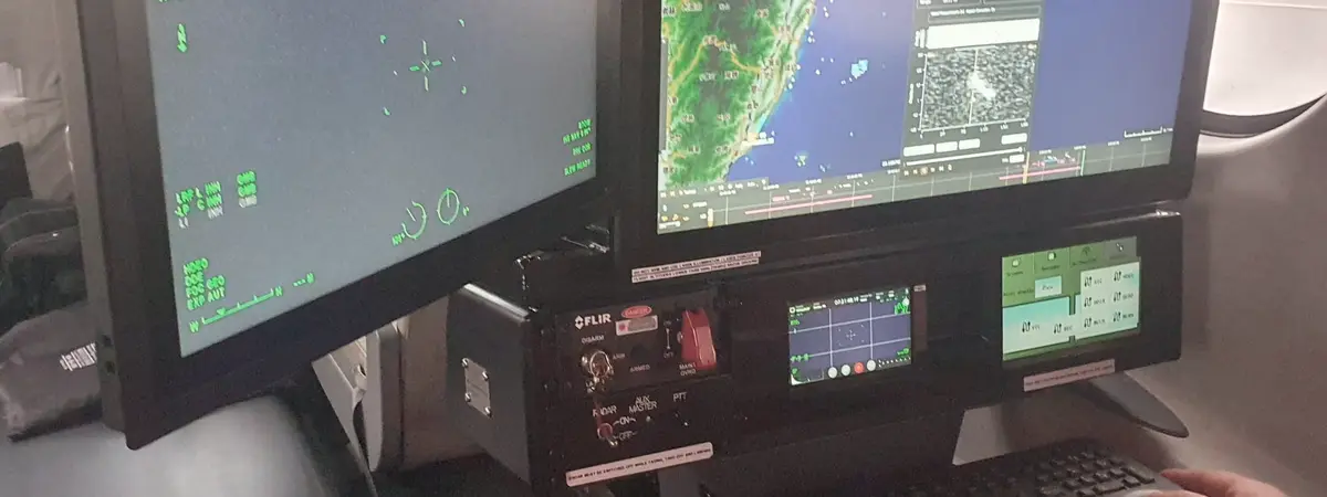
Operator console and onboard recording, so the survey data leaves the aircraft complete.
Proven in service
Approved survey installations
AIR TEAM designed and approved these survey changes as the design organisation, from mount and wiring to the flight manual supplement.
- Vulcanair P.68C-TC
- Airborne laser scanner, data recorder, position and orientation sensor, computer with display and digital camera; EASA approval 10074513 (2020)
- Cessna 208B research aircraft
- AisaIBIS hyperspectral imager for CzechGlobe (Czech Academy of Sciences); EASA minor change approval 10084937 (2024)
Key specifications
Sensor classes
- Wide-area LiDAR
- RIEGL VQ-1560 II-S (dual channel), Leica TerrainMapper-2
- Bathymetric LiDAR
- RIEGL VQ-840-G (green laser), Teledyne Optech CZMIL SuperNova
- UAV LiDAR
- RIEGL miniVUX-3UAV
- Navigation
- GSS GeoPro INS, Honeywell HG1930 IMU
Deliverables the installation supports
- Imagery
- 2D orthophoto, 3D models
- LiDAR
- DEM/DSM, canopy height and biomass, volumes, flood models
- Spectral
- Mineral, vegetation and environmental maps
- Platforms
- Fixed-wing for large areas, helicopters for low corridor work
Certification and support
Certified installation
AIR TEAM Engineering designs the mount, fuselage opening and wiring and takes the change through approval.
In-house manufacturing
Brackets, fairings and harnesses made in our own shop: CNC, 3D printing and a clean-room electronics lab.
Ground and flight test
System checks on the ground and in the air before the aircraft goes back to survey work.
Maintenance and sensor swaps
Part-145 maintenance at Kunovice and support when you change or upgrade the sensor.
AIR TEAM Engineering designs the change under EASA design approval EASA.21J.849. AIR TEAM service installs and maintains it at Kunovice (LKKU) under EASA Part-145 CZ.145.0094 and Military Part-145 CZE.145.1004, and manufactures parts under POA CZ.21G.0075. Defence quality management is certified to NATO AQAP 2110, the quality system to ISO 9001:2015. ITAR and military trade licences are in place. All approvals →
Planning a mission-system programme?
Tell us the platform and the mission. We reply within 1 business day.